
A boarding pass and a map link.
iOS 26 Wallet passes can open the airport's map, if your airline supports it.
The layover itself, and how much of it you really have, isn't counted anywhere.
Apple Maps is polished, private and great for getting from one address to another. A layover isn't an address. It's a countdown, and Apple Maps doesn't keep one.
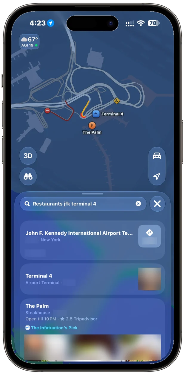
We searched “restaurants jfk terminal 4.” The first two results are the airport and the terminal itself. The first real restaurant is listed by its distance from you, with nothing about which side of security it's on or how long the walk from your gate takes.
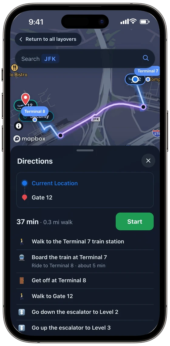
Terminal 7 to Gate 12 in Terminal 8: the walk to the AirTrain, a 5-minute ride, an escalator down to Level 2 and up to Level 3. 37 minutes, then turn by turn.
A real connection at JFK: land at Terminal 7 at 6:35 AM, leave from Terminal 8 at 6:05 PM. The terminals don't connect airside, so it means a train and a second trip through security.
iOS 26 Wallet passes can open the airport's map, if your airline supports it.
From the security line on the way out to the pickup at the other end, and how each app handles them.
Apple Maps gets you to an address. These are the parts of a trip that depend on your flights.
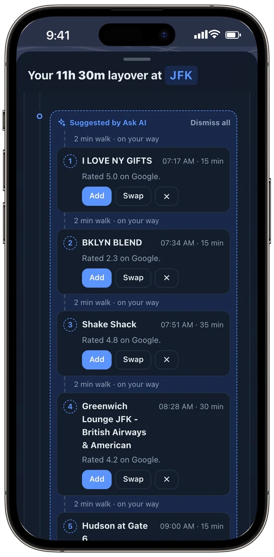
Who's traveling (kids, a dog, a wheelchair), what sounds good, and a last check. It picks real places in your terminal, in the order you'll pass them, and leaves time to spare.
By terminal and lane at 100+ airports, and counted in your time to spare.
Plus customs and passport waits for US and Schengen arrivals.
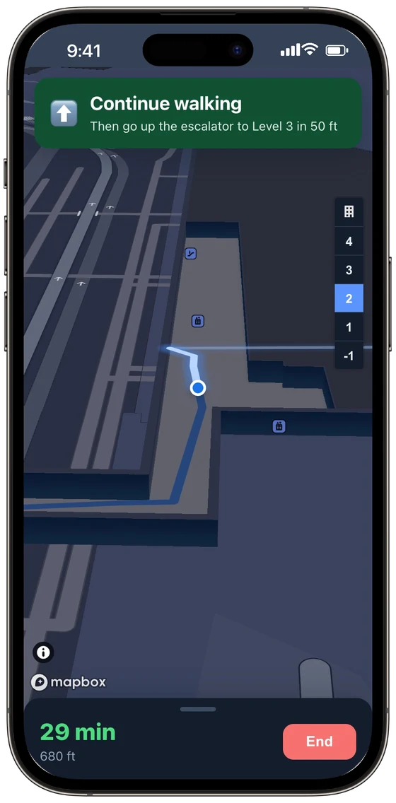
Around walls, up escalators, onto the train between terminals and through security on the way. Prefer Elevators sends every floor change to the lift.
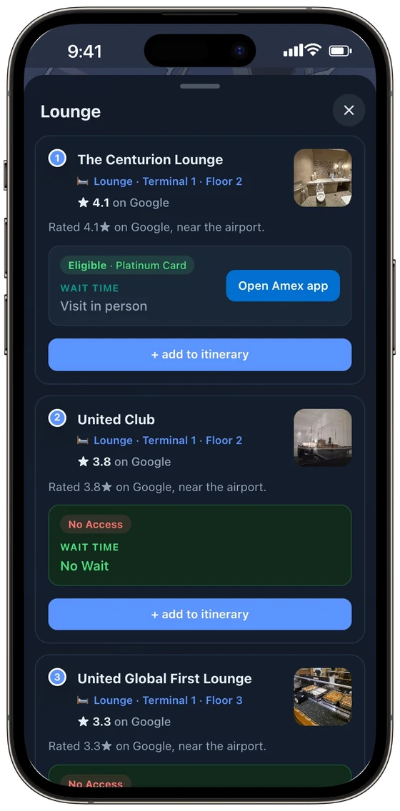
Add your cards and memberships once. Every lounge shows whether you're in, and the live waitlist when there is one.
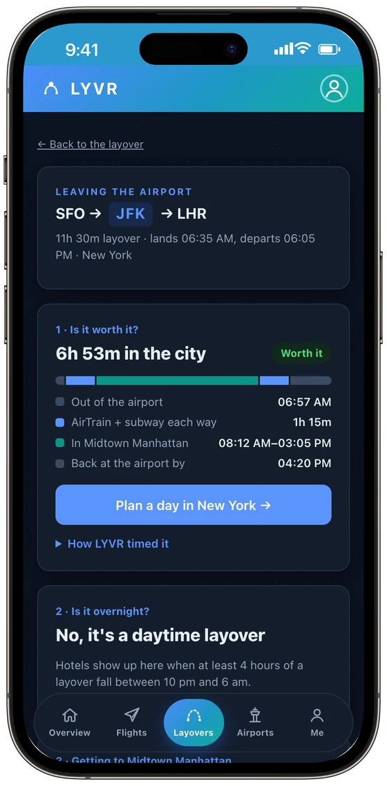
Getting out, the ride each way, security on the way back and a 30-minute cushion, checked against your passport. Then a day, planned.
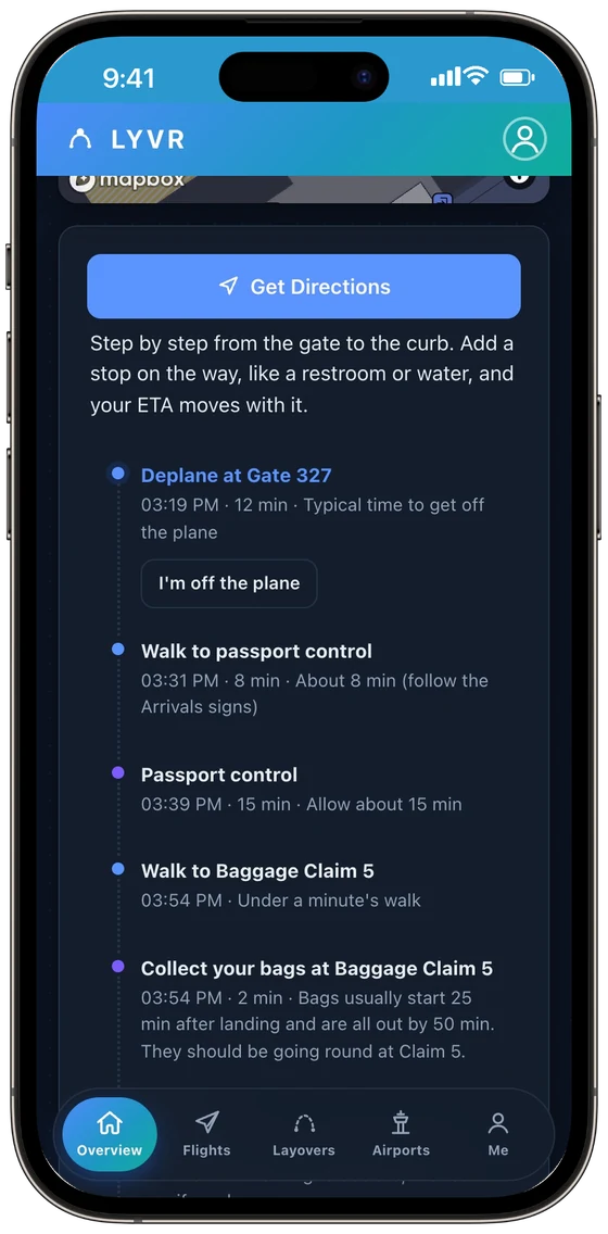
Passport control, the right belt and customs, timed from landing. Whoever's picking you up sees your ETA move, with no app and no sign-in.
Design, privacy and driving. The map is gorgeous, turn-by-turn driving on iPhone is excellent, and where Apple has drawn an airport, the floor plans are clean. None of that answers the question you have on a layover.
At some airports. Apple's own list has about 117, and several big hubs weren't on it when we checked. Where it has them, you can see gates, shops and your position, but not a timed route from one gate to another. LYVR maps the terminal, the walk and the train at any airport.
Only on the web. Apple Maps runs in mobile browsers, but there's no Apple Account sign-in there, so no saved places. LYVR is the full app in any modern browser, on Android, iPhone or a computer.
No. Apple Maps doesn't know you have a connection. LYVR pairs your flights, subtracts deplaning, every walk, train and checkpoint and the doors-close time, and shows the time you really have to spare.
Free, in your browser. Plan your first layover in a couple of minutes.
Launch LYVR →Apple Maps screenshot taken in its iPhone app, with photos, distances and drive time blurred. LYVR screenshots are from the LYVR web app on an iPhone, using a real AS26 and AA100 connection at JFK. This comparison reflects our reading of publicly available information as of October 2026. Products change, and features vary by region, device, version and airline. Apple Maps is a trademark of its owner, which is not affiliated with and does not endorse LYVR.